Saturday, October 30, 2010

Photo tour of the Ring of Fire


Mt. Redoubt chugging away, as seen from the Kenai Peninsula
Mt. Ranier looms over Seattle.
Mt. St. Helens lost about a cubic mile of material when it erupted and showered much of the northwestern U.S. with ash.
Crater Lake, in Oregon - a collapsed volcanic caldera.
Mt. Shasta, another volcano in the California portion of the Cascades


Mt. Lassen at the southern terminus of the Cascades.
Volcan Atitlan in Guatemala


Hike up Antigua's active volcano, Guatemala
Antigua and it's volcano.  Antigua is a colonial town that has been destroyed more than once by earthquakes.

Cerro Verde, near Sonsonate, El Salvador.  Growing coffee in the rich soil on the slopes of a volcano.
Caldera, Masaya Volcanic Park, Nicaragua


Omotepe Volcano from Masaya Volcanic Park, Nicaragua.  From this
vantage point, it is possible to see volcanoes of the Ring of Fire marching off in two directions.


Lake Omotepe and one of its two volcanoes, Nicaragua


Volcan Arenal erupting (about 20 times a day), Costa Rica
And again.
A pyroclastic flow down the flanks of Volcan Arenal.
Volcan Irazu, Costa Rica
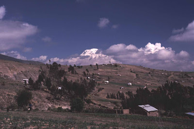
Mt. Chimberazo, Ecuador
Flight over the Andes from Quito to Cuenca, Ecuador
Volcanoes on the Bolivian Altiplano.
More volcanoes on the Altiplano
Volcan Lauca, northern Chile.
Lanin volcano, south-central Chile.
Volcan Osorno, southern Chile.
Volcan Hornopiren, Chilean Patagonia.
Torres del Paine, Chilean Patagonia.
Multi-colored crater lakes, Kelimutu, Isand of Flores, Indonesia
Steaming jungle, smoking volcanoes and ancient temples.  Borobudur, Java, Indonesia.
"Tsunami" is a Japanese word, after all.
Japan's signature volcano, Fuji-san.


Mt. Fuji sunrise from Kitadake, Japan.


Module IV - Volcanoes, Earthquakes and Tsunamis, Oh, My!

Explain - What new learning have I taken from this module?

This module was a great reminder that the forces of tectonic plate movement are huge, all around us and have tremendous impact on both environments and human societies.  The videos about hotspot volcanism and the tsunami in Lituya Bay were quite impressive.  Having been to Hawaii, Easter Island and the Galapagos Islands - all islands formed by hotspot volcanism - it was great to be reminded of how they formed.  If you'd like, check out my photo tour of hotspot volcanism post.  I've also just completed a photo tour of the Ring of Fire post.

Extend and Evaluate - How can I use this Week's resources and how useful, insightful or relevant are this module's information resources to me?

I particularly enjoyed this week's exercise with Google Earth.  I found the ruler and path maker to be very useful tools.  I also enjoyed exploring TD's resources on Alaskan volcanoes and found that that would be very useful to show my students in helping us study volcanoes and also to demonstrate the value of satellite information in geology.


I found the video about Lituya Bay to be a gripping real-life story.  It must have been an awesome and terrifying sight to see that huge wave bearing down on their little boat.  Google Earth was instrumental in bringing to light the dynamics of that little bay.  It allows you to see the fault running perpendicularly to the length of the bay and to see the "bathtub ring" created by the tsunami's devastating effects on the shoreline vegetation.

In my experience, the students really get interested in personal stories and bringing these experiences into the classroom helps them relate to the subject being studied.  In the past, I have shared my stories of having experienced the Loma Prieta (San Francisco) earthquake of 1989, having camped at the base of one of the world's most active volcanoes in Costa Rica for two weeks on a volcanic expedition and having hiked out to an active lava flow in Volcanoes National Park in Hawaii.  Watching the video on Valdez made me think about the teacher that I worked with several years ago who had grown up in Valdez and vividly remembered living through the Good Friday Earthquake as a boy.  I'm sure his students were as enthralled by his stories as I was.

Three Comments
I enjoyed Matt's blog about primary and secondary waves and using information from those wave to not only give a warning about earthquakes but to make inferences about the structure of the Earth's interior, as well.  I also particularly like his impressive entry about the history of human societies.

Ernestine's blog had some great links to pages of the USGS website.

The link to the history of the Smoot on Alison's blog was interesting and entertaining.


Photo tour of hot spot volcanism


Controversial Keck telescopes atop Mauna Kea, Hawaii 
 Lava flows across road, Big Island, Hawaii.  Here's a volcano that impacted modern society.
 Pahoehoe lava flow in Volcanoes National Park, Big Island, HI.
 Looking in a skylight of an active lava tube.  The fuzzy stuff that looks like cobwebs hanging from the top of the skylight is actually vaporized lava that has recondensed in fine strands.  Known as Pele's (the fire goddess) hair.


Kilauea caldera floor, Volacnoes National Park, HI
 Spatter cones, Bartolome', Galapagos Islands
 Sombrero Chino, Galapagos Islands
 Sea lions basking on a red-volcanic-sand beach, Rabida Island,  Galapagos Islands
 Lava fields, Santiago Island,  Galapagos Islands
Two differently-colored lava flows, Santiago Island,  Galapagos Islands
 Rano Rarako quarry.  Volcanic rock quarry from which Easter Island statues were carved.
Scattered remains of a vanished society, Tongariki, Easter Island.


Red volcanic rock quarry from which topknots were carved, Puna pau, Easter Island

Thursday, October 21, 2010

Module III - The Landscapes of Life

Explain - What new learning have I taken from this module?
What I found interesting, in this module, is thinking about how the landscape and the environment affect the human cultures that inhabit them.  In the western urbanized world, we like to think of ourselves as masters of our environment and of the land.  Clearly, events like Hurricane Katrina, Mt. Redoubt eruptions, coral bleaching, mass extinctions and the Chilean earthquake (need I go on?) belie that notion.  The Native notion that we are part of the landscape and that we need to use and conserve the resources that are available to us locally is much more sustainable.  Western culture often takes from the land while Natives often act as stewards of the land so that future generations can continue to live on the richness of the environment as the present generation does.

Jared Diamond's book "Guns, Germs and Steel" gives great examples of how the environment has affected the development of societies around the world and why some became more "advanced" than others.  He showed that many of the differences in societies were due to differences in the landscape and environment in which they evolved.  The cultures that adapted to their environment - instead of the cultures that tried to change the environment - are the ones that generally flourished.  The same author's book "Collapse" shows what happened to societies that were not good stewards of the land and resources, among other factors.

Extend and Evaluate - How can I use this week's resources and how useful, insightful or relevant are this module's information resources to me?

I often have students ask, "How can I use this science that you're teaching?"  The video about Richard Glenn is a great answer to that question, as well a great example of how Natives can embrace Western science without losing their place in the world.  When I was in Atqasuk, I did have scientists - both Native and non-Native - come into the science classes to talk about their work and its relevance to Atqasuk and the Inupiat people as well as career opportunites in their fields.  It was highly enlightening for both my students and myself.  This module reminded me that I need to do that here in Kenai, as well.

The videos on plate tectonics and the interactive images on plate boundaries and the locations of earthquakes, plate boundaries and volcanoes will be very useful in my Earth science classes, later in the year, when we get to those topics.  I also plan to use the information from the cultural connections video to demonstrate why the landforms produced by tectonic activity have relevence to our society.  Living in an area that has recently been impacted by Mt. Redoubt eruptions, this will be particularly powerful for Kenai students.

Three Comments

Carolyn's Explore 907 post is enjoyable and intersting.  I agreed with her particularly liking Richard Glenn's comment about the Native way of seeing the world and Western science merely being two flashlights shining down the same path. 
It sounds like Alison (Explore Alaska with Alison) lead a very magical and fortunate life as a child spending Alaskan winters in a remote cabin.
Dan Adair's blog mentioned the usefulness of the videos and of Google Earth for visual learners as well as the possibility of expanding studies of the Native view of the world to that of Natives outside of Alaska.

Sunday, October 17, 2010

Module II Everything is connected

Explain - What new learning have I taken from this module?
"Everything is connected" was a great synopsis of how Native ways of knowing relate to Western science.  I found the Venn diagram to be a great visual of the ways the two systems differ and where they converge.  Having read books like "The Tau of Physics" and "The Whale and The Supercomputer" (both of which I highly recommend in the context of this course), I didn't find these concepts new, but these ideas cannot be reinforced enough.  The specialized fields of modern science can learn a valuable lesson from the holistic Native view of the world.

Extend - How can I use this week's resources and/or others in the community in my lessons?
I found the "Earth as a System" video to be a great summary of how the different disciplines of Earth Science can by synthesized into a single world view that approaches the holistic Native view of the planet.  It is a great visual and, I believe, very appropriate to show to students at almost any point in almost any science class, though particularly apt in an Earth science class.  I also thought that the YouTube video was a great motivator and I will show that in my classes, this week.


Evaluate - How useful, insightful or relevant are this module's information and resources for me?
I found the trip to Google Earth to be very useful.  Though I have fooled around with it a little in the past, I find that the newer version has great potential in the context of this class and of the classroom, too.  Though our district uses the discoveryeducation website, I found that Teacher's Domain will be very useful.  The two sites are similar, but it never hurts to have more resources at your fingertips.

Three Comments
I enjoyed Alicia's Science Exploration blog, her take on the Venn diagram and views of her pre-wedding-day home.
Amy's Explore Alaska site was refreshing to see Alaska through the eyes of a first-year bush teacher and Cheryl's Explore Palmer site drew fascinating parallels between scientists' views on the behavior of electrons, Native ways of knowing the world and her driving record.

Wednesday, October 6, 2010

One of my favorite places

One of my favorite places on the planet is southern Chile. It's packed with awe-inspiring fjords, glaciers, volcanoes and beautiful lakes. This, combined with friendly locals and superb local cuisine, make for some prime cycling, kayaking and camping. It's a great place to spend an Alaskan winter!


I was born in Cape Town, South Africa, a place surrounded by low mountains and a coastline shaped by two different ocean currents.  The region has a mild semi-arid climate, ideal for vinticulture.